Press Release

MultiSet AI has launched Map Versioning, the first VPS-native system that treats enterprise spatial maps as a versioned, upgradeable substrate. With Map Versioning, the spatial content layer — anchors, AR work instructions, navigation paths, training overlays, digital twin links — is decoupled from the underlying scan. Operators rescan their facilities when the physical space changes; the platforms and builders that depend on those maps keep shipping, with no re-authoring required.
Every enterprise spatial deployment runs into the same wall. A facility is mapped, content is authored against the map, the deployment ships. Then the physical space changes — equipment relocates, fixtures swap, walls get repainted, new infrastructure goes in. Across the rest of the VPS market, spatial maps are treated as discrete, unrelated captures with no temporal relationship to one another. When the space changes, the only option is to rescan from scratch and re-author every piece of spatial content built against the old map.
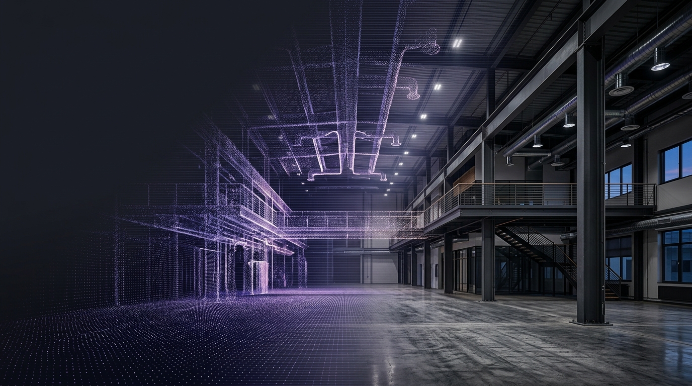
Map Versioning closes this gap. It is the first VPS primitive built around the recognition that production spatial maps are not snapshots. They are living infrastructure that must evolve as the physical world does.
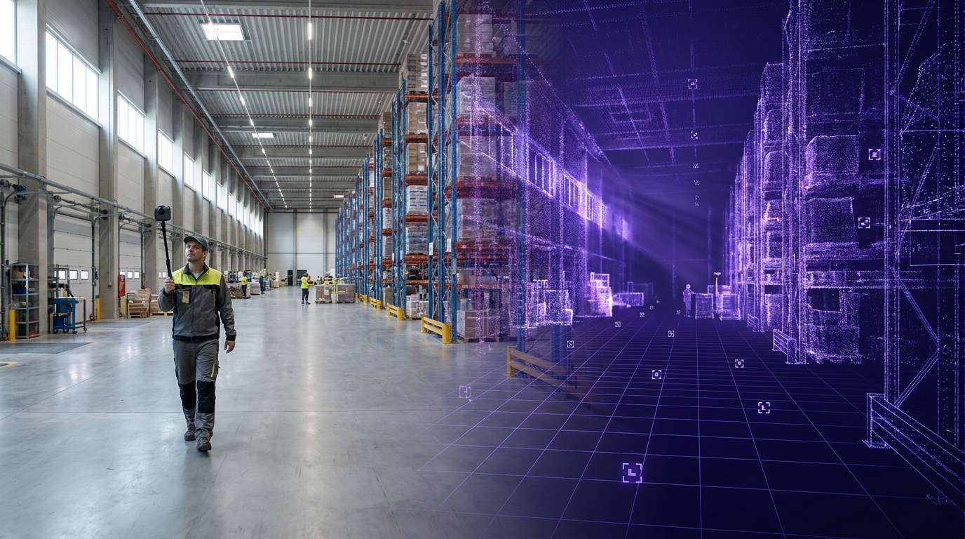
A Map Version groups two or more scans of the same physical space into a single coordinate system. One scan is the base map, and its coordinate frame is the one the developer's content layer is authored against. Every other scan added to the version is aligned to that base by the MultiSet VPS, which computes a rigid transform between the two captures.
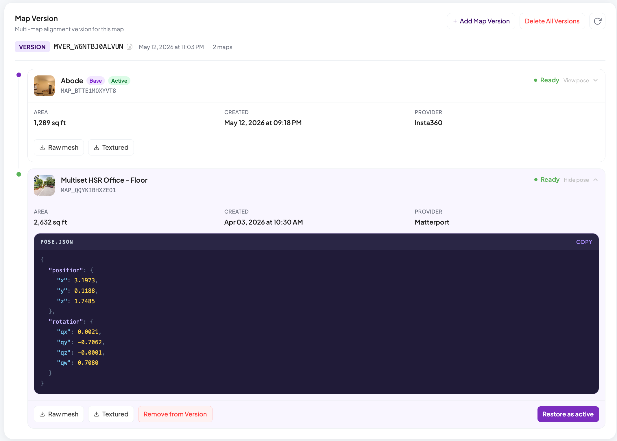
One map in the version is always active. VPS queries against the base map's identifier are silently routed to the active map, and the returned pose is transformed back into the base frame. Content never moves. Each new rescan is aligned against the currently active map rather than the original base, so alignment quality holds even as the space drifts further from the original capture over months and years.
Traditional scan-merging techniques like Iterative Closest Point (ICP) and low-level geometric or visual matchers only work when two scans look nearly identical. They fail in exactly the cases that matter in production: rearranged furniture, swapped fixtures, different hardware, different coordinate conventions, different sensor densities (iPhone LiDAR vs. Matterport vs. Leica), different lighting and seasons, months between captures.
Map Versioning runs on the same VPS pipeline that powers MultiSet localization. Because the VPS reasons about the scene at the level of recognizable structure rather than raw geometry, it stays robust under drastic change between captures — and returns a clean rigid transform between the new scan and the base map where ICP would have given up.
Map Versioning composes cleanly with MapSet, MultiSet's infinite-scale spatial composition layer. MapSet groups maps that cover different physical areas of a venue — floors, zones, indoor-to-outdoor transitions, campus-wide coverage. Map Versioning groups scans of the same area over time. Rescanning a single floor inside a MapSet leaves every other floor's alignment untouched.
It is also fully scan-agnostic. Versions in the same group can be captured with completely different hardware: the MultiSet Mapper iOS app, Insta360, and Matterport, Leica, NavVis, Faro, and XGRIDS professional scanners. A space mapped quickly with a phone today can be upgraded to a high-fidelity professional scan next quarter without the content layer ever being touched.
Operators running industrial sites, retail floors, construction projects, and campuses can refresh their production maps on whatever cadence the physical space demands — daily, monthly, quarterly — without disrupting AR work instructions, asset navigation, training overlays, or digital twin anchors authored against the original.
Platforms and OEMs embedding MultiSet inside their own products gain a stable spatial substrate they can guarantee their integrations against. The map underneath can evolve on the customer's schedule; the platform's spatial features keep working.
Builders authoring AR experiences, robotics workflows, and connected-worker applications no longer have to choose between fast initial capture and high-fidelity production capture. Start with a phone, upgrade to Leica or Matterport later. The content layer doesn't care.
MultiSet AI provides the foundational spatial intelligence infrastructure for enterprise augmented reality. By delivering the world's most robust scan-agnostic Visual Positioning System, MultiSet enables organizations to build, self-host, and scale persistent AR experiences with uncompromising accuracy and full data sovereignty.