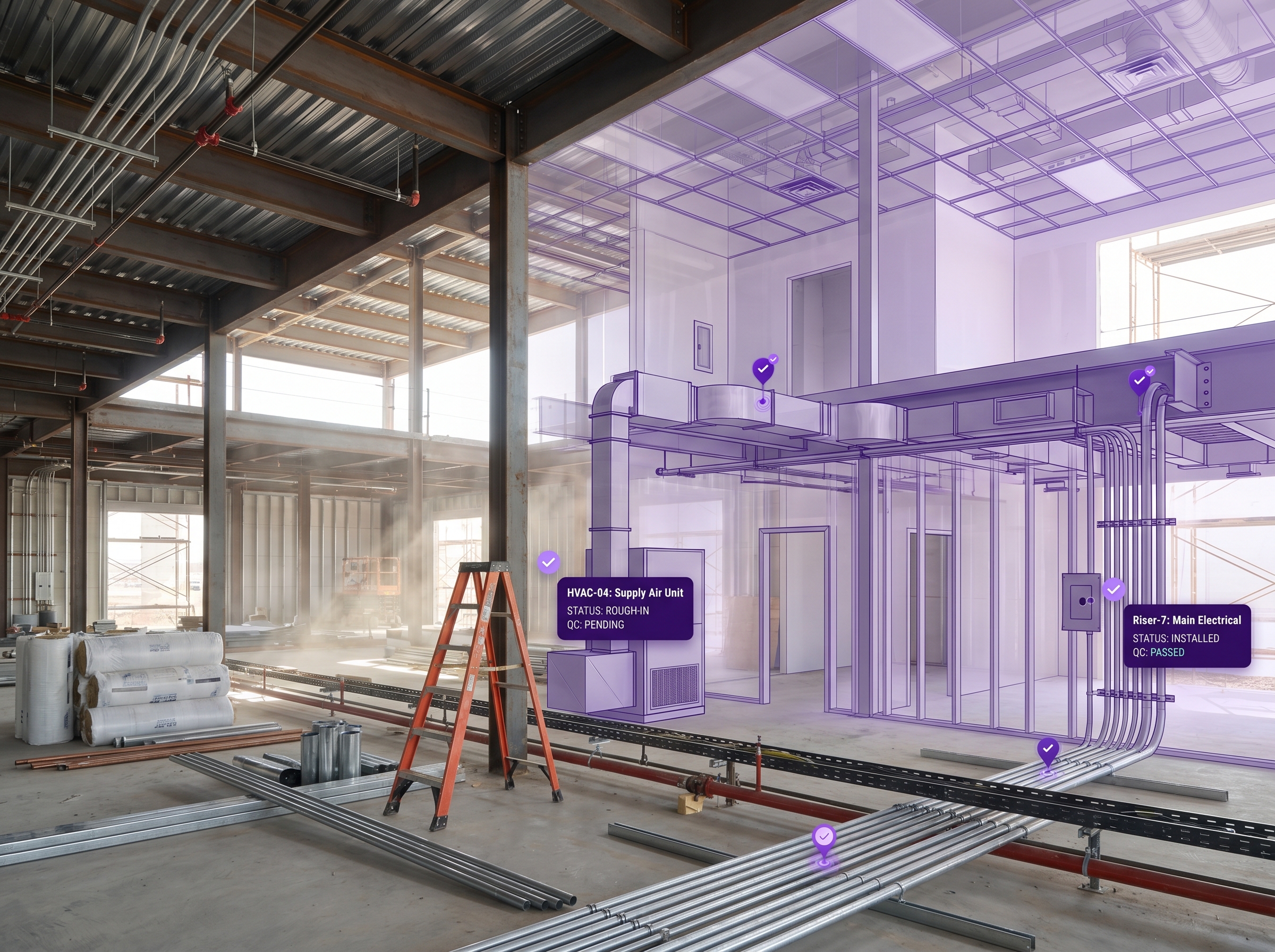
CAPABILITY
WITHOUT MAP VERSIONING
WITH MAP VERSIONING
Map updates
Re-scan from scratch, replace production map
Add a new scan to the existing map version group
Annotation layer
Re-author anchors, navigation paths and overlays every cycle
Native MapSet with stitching & seamless transitions across floors/areas
Re-scan hardware
Locked to original capture device for alignment
Any combination — iPhone, Insta360, Matterport, Leica, NavVis, Faro, XGRIDS
Scan alignment
Iterative Closest Point fails when geometry changes
VPS-powered rigid transform handles real-world change
Operating cadence
Quarterly or annual rebuilds
Daily, weekly, on-event — whatever the space demands
Coordinate continuity
Each new scan creates a fresh coordinate frame
Base map frame persists; content stays anchored
Production risk profile
Map updates are rebuild-the-world events
Map updates are routine operations
Fidelity upgrade path
New scan = new map = new content authoring cycle
Phone capture today, professional scanner next quarter — same map