Spatial AI for AEC Field Execution
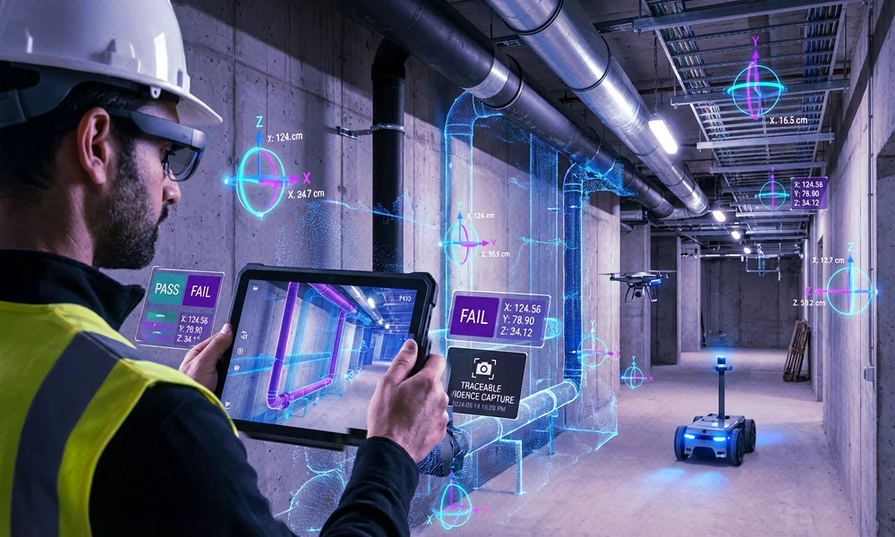
AR QA & Commissioning for Construction & Infrastructure
Align BIM and as-builts with reality for layout checks, commissioning and utility locating—capture traceable evidence with precise 6-DoF poses, even on sensitive, offline sites.