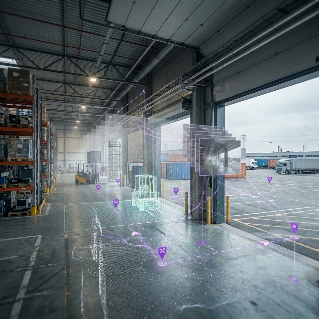
Construction AR localization is one of those topics that looks solved in a demo and becomes brutally honest on a jobsite. If you’ve ever run a BIM overlay experience with QR codes or AprilTags, you already know the pattern: scan, snap, celebrate… then drift.
If you’ve deployed AR on a construction site, you’ve probably experienced the “QR-code honeymoon.” You scan a tag. The BIM overlay snaps into place. Everyone smiles because, for one glorious moment, the model and reality agree. Then you walk 30 meters, turn a corner, and your overlay starts drifting off the wall like it’s slowly losing faith in geometry.
That moment isn’t a failure of AR. It’s a failure of assumptions—specifically, the assumption that a single “perfect initialization” is enough to support continuous, jobsite-scale tracking.
This is written primarily for AEC innovation leaders, VDC and digital delivery teams, and XR developers building QA/QC overlays, commissioning workflows, and navigation experiences. But the same decision shows up in manufacturing (work instructions), logistics (navigation and picking), and robotics (shared localization between humans and machines). If you care about persistent 6DoF pose, you’re in the right place.
For MultiSet context as you read: Visual Positioning System (VPS), scan-agnostic mapping, developer docs, and MapSet (multi-map stitching).
Quick comparison
| Marker-based | Markerless VPS | Hybrid | |
|---|---|---|---|
| Start | Scan tag | Relock on map | Tag or auto |
| Drift | Accumulates | Corrects | Corrects |
| Scale | More tags | More maps | Fewer tags + maps |
| Ops | Field upkeep | Map lifecycle | Balanced |
| Best | Point tasks | Site / portfolio | Most AEC |
If you only remember one thing from this article, it’s this: markers are fantastic control points. Markerless VPS is how you keep accuracy across the space between control points—without turning your jobsite into a sticker farm.
The AEC reality: “perfect start” is easy; “staying correct” is hard
Marker-based solutions feel incredible at initialization because they give the system a known geometric object with known dimensions. That’s catnip for pose estimation. In AEC, the operational appeal is equally strong: “scan here” is easy to train, easy to audit, and easy to troubleshoot. When a team is new to construction AR localization, markers are often the fastest way to earn trust.
But once you walk away from the marker, most systems shift into continuous tracking using visual-inertial odometry (camera + IMU). That tracking is a relative estimate. Small errors accumulate, and jobsites are full of conditions that amplify those errors: low texture surfaces, reflective materials, repetitive corridors, moving people, temporary occlusions, harsh lighting transitions, dust, and frequent layout changes.
Markerless systems exist because large-scale and persistent use cases need a way to “pull back” drift without requiring a human to constantly re-scan. In practice, that means anchoring the experience to a map or digital twin of the environment, so the system can relocalize when confidence drops.
What works where (AEC-first, broad enough for other industries)
| Scenario (real world) | Marker-based (QR/AprilTag) | Markerless VPS | Best-fit pattern |
|---|---|---|---|
| Single station task (stand here, verify this) | Excellent | Good | Marker-first |
| Short walk in a controlled bay | Good | Good | Either |
| Multi-room walk (corridors, turns, occlusions) | Drift unless re-scan | Designed for relock | VPS-first |
| Multi-floor workflows | Tag density grows | Map stitching / MapSet | VPS-first |
| Repeated tasks over weeks/months | Tags degrade/move | Persistent reference | VPS-first |
| High-change jobsite phase | Tags get blocked/removed | Map updates needed | Hybrid + versioning |
| Feature-poor spaces (blank walls, glass) | Works if tag visible | Harder without features | Hybrid |
| Offline / restricted networks | Easy | Depends on deployment | Depends on deployment |
| Multi-user shared alignment | Needs shared tag frame | Shared map frame | VPS-first |
| Robotics + human coordination | Tag infra required | Shared world model | VPS-first |
Two things jump out from this table. First: markers aren’t “legacy.” They’re simply optimized for localized tasks and deterministic start points. Second: the moment your workflow demands continuity across rooms, floors, or time—especially if you want multiple users to share a coordinate frame—markerless becomes less of a feature and more of a platform requirement.
This is the main positioning nuance I recommend for AEC teams already invested in marker workflows: don’t frame it as “replace QR.” Frame it as “keep QR where it’s the right tool, and stop depending on QR everywhere.”
Technical deep dive: how pose is estimated in both approaches
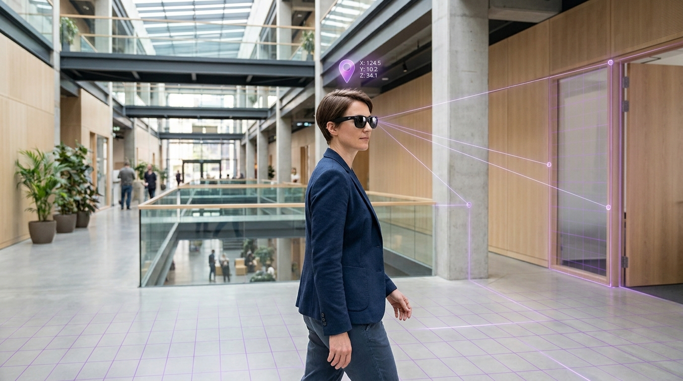
Let’s get technical without losing the plot. In both marker-based and markerless systems we ultimately want the same output: a 6DoF pose for the camera—rotation R and translation t—in a coordinate frame we care about (marker frame, map frame, BIM frame, or some project-defined world frame).
At a high level, pose estimation is about connecting the 2D image to 3D reality. We observe pixel coordinates in the camera image and want to infer where the camera is relative to a set of known 3D points. Both approaches lean on similar math at the “solve” step (PnP is everywhere), but they differ dramatically in how they obtain reliable correspondences and how they control drift over time.
Marker-based pose estimation (QR / AprilTag / ArUco)
What the system gets for free: known geometry. A fiducial marker is engineered to be easy to detect and to provide stable corner points. If you know the camera intrinsics and the physical size of the marker, you can estimate pose in metric units.
Typical pipeline:
- Detect the marker in the camera image (tag-specific detection + ID decoding).
- Extract 2D features (usually the four corners in pixel coordinates).
- Assign known 3D coordinates to those corners in marker space (e.g., (0,0,0), (W,0,0), (W,H,0), (0,H,0)).
- Solve PnP to recover the camera pose (R, t) that best explains the observed 2D projections.
- Track continuously as the user moves, typically using visual-inertial odometry (VIO): integrate IMU readings and track image features frame-to-frame.
- Re-anchor as needed by scanning again, scanning a nearby tag, or using multiple tags to stabilize the coordinate frame.
Why initialization is so strong: marker-based initialization is a tightly constrained geometric problem. You’re not asking the system to “understand the environment”; you’re asking it to estimate pose relative to a known plane with known corner coordinates. In clean conditions (good lighting, sufficient pixel coverage, little motion blur), this can be extremely accurate.
Where accuracy degrades: marker-based accuracy drops as the marker becomes visually small (far away), oblique (high angle), partially occluded, or distorted by motion blur and rolling shutter. The marker still provides a pose, but the pose becomes noisier. In the real world, that can look like a slight wobble or misalignment at the start. Then, once you’re tracking away from the marker, you’re primarily at the mercy of local tracking drift.
The drift mechanism (plain language): VIO is essentially estimating motion increments. If each increment has a tiny bias, those biases accumulate. The longer you walk and the more visually challenging the environment, the more drift you collect. If you don’t reset, you’re carrying that error forward.
Pros (marker-based pose):
- Deterministic anchoring at a known point. Great for localized AEC tasks like “verify this installation detail.”
- Low digital setup when you can place a tag quickly and don’t need a full site map.
- Works in feature-poor environments because the marker is the feature (blank corridors still work if the tag is visible).
- Compute-friendly relative to global map localization.
Cons (marker-based pose):
- Line-of-sight dependency (tags get occluded, dirty, painted over, moved, or removed).
- Operational scaling is linear: more area → more tags → more install/QA/maintenance/governance.
- User interruption if frequent rescans are required to keep overlays trustworthy.
- Single-point truth unless you build a dense infrastructure of anchors or implement more complex multi-marker optimization.
Markers are not the wrong tool. They’re the right tool when the job is localized, the environment is controlled at the anchor point, and you can tolerate—or even prefer—explicit user actions for initialization and recovery.
Markerless VPS pose estimation (map-based localization + tracking)
Markerless VPS changes the premise: the environment becomes the anchor. Instead of relying on a single fiducial control point, the system relies on a map or digital twin that represents stable visual structure. That map might be a sparse feature map, a dense point cloud, a mesh, or another representation. In AEC, the key is that the representation can be tied to the coordinate frame you care about—often the project’s BIM or as-built frame.
Two phases matter: mapping and localization.
Phase 1: Mapping creates the reference the system will later use for localization. In construction and facilities, this increasingly aligns with existing reality capture workflows. If you already have Matterport, NavVis, Leica, or other scans, the fastest path is to reuse them rather than recapture. MultiSet leans into this with scan-agnostic ingest and third-party scan support (including E57), so the mapping step can align with how AEC teams already operate: scan-agnostic mapping and E57 / third-party scans.
Phase 2: Localization estimates pose inside that reference. The classic VPS approach looks like this:
- Extract features/descriptors from the live camera frame. These can be classical keypoints or learned descriptors, depending on the system.
- Retrieve candidate map regions (place recognition). This reduces the search space so you’re not matching against an entire building at once.
- Match 2D ↔ 3D correspondences: live image features to map landmarks (or to dense geometry-derived features).
- Estimate an initial pose using robust methods (often RANSAC + PnP) to reject outliers.
- Refine pose with optimization (bundle adjustment, pose graph constraints, or other refinement depending on map representation).
- Track locally using VIO between “global checks.”
- Relocalize when needed to correct drift when confidence drops, or continuously fuse map constraints to keep the pose tethered to the reference frame.
Why VPS helps with drift: the important difference is step 7. Marker-based pipelines typically rely on the user (or infrastructure density) to re-anchor. VPS pipelines can re-anchor against the map when tracking becomes uncertain. Put simply: VIO propagates; VPS corrects. That correction is the difference between “good for 10 meters” and “good for the whole floor.”
What theorists love (and what practitioners should care about): map-based localization turns localization into a probabilistic matching problem rather than a deterministic marker solve. That introduces complexity, but also resilience. When the system can observe many stable features across the environment, it has more ways to regain confidence. It can often recover from occlusions, partial view, and path variation—without forcing a human to stop, find a tag, and rescan.
Where VPS struggles: no system is magic. Markerless approaches can struggle in feature-poor areas (long uniform corridors, blank drywall, glass-heavy spaces), in environments with significant changes from the mapped reference (temporary walls, major demolition, seasonal changes), and in conditions that degrade imaging (extreme glare, low light, heavy motion blur). The right operational response is not denial—it’s architecture: version maps by phase, use MapSet for large areas, and keep sparse “safety rails” where features are weak.
Pros (markerless VPS pose):
- Drift correction via relocalization instead of frequent rescans.
- Persistence across sessions and devices because the reference map defines a shared coordinate frame.
- Scales without physical marker infrastructure across large facilities and multi-floor venues.
- Enables multi-map stitching for large environments (see MultiSet’s MapSet concept).
Cons (markerless VPS pose):
- Requires a map asset and a lifecycle for updates when the site changes.
- Higher compute/data complexity than a single-marker solve.
- Dependence on stable visual structure (feature quality matters).
From a business perspective, the key reframing is this: markerless VPS shifts effort from maintaining distributed physical anchors to maintaining a versioned digital asset. In AEC—where reality capture is already a standard practice—this often aligns better with how teams work.
Pros and cons by subsystem
| Subsystem | Marker-based (pros) | Marker-based (cons) | Markerless VPS (pros) | Markerless VPS (cons) |
|---|---|---|---|---|
| Initialization | Deterministic, fast | Needs line-of-sight + pixel size | Can be hands-free | Needs map + match confidence |
| Scale | Simple conceptually | Ops grows linearly | Software-scale coverage | Mapping/versioning needed |
| Drift | Fine with frequent resets | Accumulates otherwise | Correctable via relock | Harder in feature-poor areas |
| Ops | Easy to start small | Tags degrade/move/occlude | Digital asset lifecycle | Map updates in changing zones |
| Training | “Scan here” is easy | “Rescan when…” adds friction | Fewer user interrupts | Requires trust in recovery |
| Governance | Manageable at small scale | Becomes infrastructure | Central map management | Needs ownership + cadence |
This table is where “technical” becomes “buyable.” In AEC, success is usually less about a single algorithm and more about whether the organization can reliably operate the system. If your localization stack depends on inputs that your team can’t keep stable—physical tags everywhere, or maps that never get updated—then you don’t have a tech problem; you have an operations problem.
Failure modes and why hybrid is the deployment shape that actually ships
AEC teams don’t choose markers because they love printing. They choose markers because they trust the workflow. If you try to rip that trust out on day one, you’ll get pushback—even if your underlying technology is better. The practical path is hybrid: keep the behaviors that crews already understand, while removing the need to depend on physical anchors everywhere.
| On-site reality | Marker-only outcome | VPS-only outcome | Hybrid outcome |
|---|---|---|---|
| Tag gets painted over | No start / workaround | No dependency on tag | VPS continues + keep reset points |
| Corridor is feature-poor | Works if tag present | Matching may be weak | Sparse reset tags at transitions |
| Space changes weekly | Tag registry needs updates | Map versioning required | Version maps + tag safety rails |
| Crew hates extra steps | Frequent rescans frustrate | Auto relock reduces friction | Scan once, then walk |
| Multi-floor commissioning | Tag density explodes | Map stitching supports scale | Tag at stairs + VPS across floors |
If you want a single positioning sentence that feels non-disruptive, it’s this:
This gives marker-first organizations a migration path that doesn’t invalidate their existing investments. It also lets you be honest about edge cases: if a hallway is feature-poor, keep a sparse reset marker at the transition. If a phase changes weekly, version the map for that zone. Hybrid is not a compromise; it’s a production architecture.
The operational cost comparison: sticker lifecycle vs map lifecycle
I’ve said “ops” a lot because it’s the part most teams underestimate. Printing markers is cheap. Keeping a marker network reliable is where the money goes: planning, placement, documentation, QA, replacement, and ongoing governance. The failure mode is also very visible: if the tag isn’t scannable, the workflow stalls.
Markerless VPS shifts cost into the mapping lifecycle: capturing or ingesting a map, validating it, versioning it when the environment changes, and distributing the right map(s) to the right users or devices. The failure mode tends to be less binary. Localization might take longer, confidence might drop, or the system might need to relock. In many workflows, that’s a better failure profile than “you can’t start.”
For AEC teams already doing reality capture, this shift is often practical rather than disruptive. MultiSet’s scan-agnostic approach is designed to fit into existing capture ecosystems (including E57 from third-party scanners), so the mapping step can align with your current digital delivery workflows: MultiSet VPS supports third-party scans and third-party scan docs.
A pragmatic hybrid rollout plan for construction AR localization
Here’s the rollout I like because it respects jobsite reality and produces measurable wins quickly.
Phase 1 (Weeks 1–2): Keep the QR ritual, redefine what it does
Keep the scan exactly where crews expect it (entry point, trailer, room threshold). But make the scan serve as an experience launcher and optional reset—not as the system’s only source of truth. Then let VPS carry continuous pose as the user moves.
MultiSet supports multi-map scaling with MapSet, which is a practical tool once your pilot expands beyond a single zone: MapSet: multiple maps.
Phase 2 (Weeks 3–6): Add sparse reset points at natural transitions
Instead of one tag per room, place reset points like control points: stairs, elevators, corridor junctions, entrances to high-value commissioning zones. The goal isn’t density; it’s predictable recovery. This is also the phase where you build trust with supervisors: “It stays correct while walking typical paths.”
Phase 3 (Weeks 7–12): Scale by zones and floors, then reduce marker dependence
Now expand your coverage with stitched maps rather than more stickers. Keep only the markers that demonstrably reduce risk in feature-poor areas or high-change zones. The end state is not “no markers.” The end state is “markers are optional safety rails, not the core infrastructure.”
Where MultiSet fits
When you evaluate localization stacks for AEC, you’re usually evaluating more than pose estimation. You’re evaluating whether the system can be reliable across real environments, whether it fits your capture ecosystem, and whether it can be deployed in a way that satisfies enterprise security and operations. MultiSet’s positioning centers on high-accuracy localization with low drift, scan-agnostic inputs, large-scale coverage (indoors/outdoors), and flexible deployment options.
If you want to explore MultiSet directly: VPS overview, mapping overview, and the docs.
- Try the platform: Start free
- Bring your site constraints and success criteria: Book a demo
Quick FAQ
Are markers more accurate than markerless VPS?
At the instant of scanning, markers can be extremely accurate because they provide known geometry and known scale. The tradeoff is continuity. If you scan once and then rely on local tracking over long distances, drift accumulates unless you re-anchor frequently. Markerless VPS is built to relocalize against a map to reduce long-horizon drift, especially when users walk real jobsite paths.
Is markerless VPS “set it and forget it” on a construction site?
Not quite. Construction sites change. The practical approach is to treat maps as versioned assets—update the zones that change frequently and stitch the zones that remain stable. That’s still a lifecycle, but it’s a digital one, and for many AEC teams it aligns better with existing reality capture practices than maintaining distributed physical tags.
Do we need to abandon QR workflows to adopt VPS?
No—and in AEC I generally recommend you don’t. Keep QR as launchers and reset points. Let VPS handle continuous pose, multi-room continuity, and drift correction. That gives crews a familiar “start here” behavior and gives the system the ability to keep overlays honest as users move.
Closing thought
Marker-based localization earned its place in AEC because it’s simple, deterministic, and operationally legible. But as soon as your use case evolves from “stand here” to “walk the site,” you’re no longer choosing between two detection methods—you’re choosing between two operational models.
The cleanest path is almost always hybrid: keep markers where they shine (launch and reset), and use markerless VPS where scale and persistence matter. That’s how you respect crew workflows while upgrading the underlying system of record for pose.
If you want to pressure-test this on your site: start free or book a demo. And if you’re thinking about multi-zone and multi-floor coverage, it’s worth skimming MapSet early so you design your rollout for scale from day one.